
Over the last year I have had the great fortune of mind melding with various people with incredible ideas. As some of you may know, I am involved in Ushahidi, an open source platform for data collection, visualization and interactive mapping. Ushahidi has gotten its notoriety in the crowdsourcing sphere, with growing adoption around the world. From Kenya to Russia, Poland, Mexico, South Africa, Italy and countless other countries; it is something I continue to marvel at while enjoying the ride of learning; with a global community of hackers from Ghana, Malawi, Netherlands, US, Kenya, Poland etc, I marvel even more.
The idea behind the platform is simple. That anyone, given a channel to say ‘This is what I see’ and send that information via SMS, email, web and twitter. With Ushahidi’s plethora of mobile apps, reporting via smartphones can also be done quite seamlessly. With the Android app SMSsync, you can be your own SMS gateway. What this means is you can run a hub from your Android phone, such that any sms’s sent to you get sync’ed with a call back URL which can be an Ushahidi deployment or another server based application. So with the channels of data collection sorted, you of course have the processing capability that is available on the cloud (Think SwiftRiver), and the visualization component which can help convey the data in a compelling way.Maps. Things are getting even more compelling with plugins such as Cloudmade (Think preety, preety maps), and bookmarklets that can overlay Ushahidi data with other data available in the open layers format. Point is, the tools to create a visual from the collected data is also sorted. Beautifully too.
Now to the Internet of things. My first encounter with this idea was from listening to Elder of the Internet Vint Cerf at Lift09. He mentioned how you can have sensors in your cellar that make sure the temperature of the wine stays constant, and does some automatic reporting via internet to you if there is an anomaly. Those sensors have IP addresses and are nodes in your network. I did not think of it in terms of ‘Internet of Things’ at the time, but looking back now, that is exactly what he was describing. Other sensors abound, from the innovative Enphase inverter for giving you information on your energy generation from solar panels to the trash tracking devices used in the MIT Senseable City lab projects. Another great way to grasp this concept is to check out the twitter account of London’s Tower Bridge, and read this account of how it was set to tweet.
Now take these two ideas and meld them in different ways. Allow me to use the word holistic. As in holistic near ‘real time sense-making‘, incorporating the internet of things, with crowdsourced data delivered through channels that encourage participation. There is an opportunity to see things dynamically and not just do after-the-fact post mortem. This could work for flash point events like the Haiti earthquake (taking data form Geiger counters etc + crowdsourced data like that available on the haiti deployment run by Noula.ht. It could also work for longer term events such as the BP Oil spill in Louisiana.
…the closer to real-time one can get the right answer and respond, the better. And milliseconds matter.
-Jeff Jonas on a smarter planet
– Data from things/sensors can trigger a report online if a tracked value reaches a certain threshold or meets certain criteria. For example, the Copenhagen Wheel by MIT Senseable lab. The wheel contains sensors that monitor carbon monoxide levels in the air,NOx/Nitrogen Oxides, a measure of air pollution, noise, ambient temperature and relative humidity. The data is accessible on a mobile phone app and can be shared with friends or even the city.
– Data from people filling out a form, sending an email, SMS or twitter message. This can be qualitative in nature, and use of the Ushahidi platform provides a way for citizens to participate in data gathering, plus sign up for alerts that are relevant to their concerns. An example that can be useful to check out is the Where Are The Cuts map from The Open Knowledge Foundation in the UK.
Combining the various sources of data (Open layers can be used to distinguish various types of data/color coding points of data can help to differentiate between sensor data and crowdsourced data). A dynamic map of information can then emerge that is not so much a snapshot, but an animation.
Cue: Augmented Reality (AR).
The Mobile Individual Measurements of Air Quality (MIMAQ) project out of Netherlands gives a perfect example of combining sensors, air pollution information and AR.
This wired piece on ‘When augmented reality hits the Internet of Things’ is also instructive and interesting.
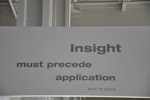
Change is at times compelled by insight. The insight from using technologies/ideas outlined above could lead to behaviour change if we can make data relevant to an individual. Relevant to the decisions they have to make based on the information they have at the time. For an idea that mixes some of the above ideas and adds relevance, have a look at Mapnificent.
Mapnificent from Stefan Wehrmeyer on Vimeo.
[Mapnificent] …allows you to set a point in your chosen city and a map will display the entire area over which you could travel by public transit in a given amount of time. It also allows you to see an area that is both 15 minutes away from yourself and 15 minutes away from a friend by transit, and since it is integrated with Google Maps, allows you to search destinations within that specified area.
The recent deployment of the Ushahidi platform by The South China Morning Post is one to watch. “CitizenMap starts with environmental issues, focusing on the destruction of natural beauty in Hong Kong – from illegal dumping to unauthorized development, from vegetation removal to columbarium construction.”

The reason why this could be interesting, is that it has the potential to give journalists leads that they can follow up on and gather more facts on issues such as toxic waste dumping. It is harnessing the power of the people to help make Hong Kong a better place. This feeds into the idea of changing behaviour. If individuals/corporations realize that the public is watching and able to report incidents, would they still engage in such activities?
Say we had near-real time crowdsourced data from the public, and data from sensors all in the public domain; what could we do? What kind of projects could we come up with?
During TEDxNairobi, Erik Kigada an architect with Planning Systems shocked many of us in the audience by revealing something we did not know about. The city of Nairobi does not have a coherent master plan. The city is using 1999 plans to build in 2010. This presents myriad problems for businesses and individuals who need to plan. His point was made stark by the road construction happening while the event was going on. If a master plan existed showing that a bypass was planned, the architect who built the auditorium would not have put it near the road. There is an opportunity for emerging economies, rapidly growing cities to become smart cities. They can do this by taking a cue from the Senseable city projects. Current, near-real time data can be gathered with the help of the crowd, to provide pertinent information to urban planners, academics and leaders. The hope here is that they can make well informed decisions that take into account the flowing reality of the city.
“Insight from data can be used to leapfrog.” -Assaf Biderman
There is also the opportunity for education and academia to use participatory systems to link science, data and student participation. Relating the exploration of built/urban environment to the scientific method of observation, data collection and analysis.
I am interested in your ideas on how we can use these technologies and ideas to address the many challenges facing our world in Health, Education and Environment. I am particularly interested in figuring out a joint project in Kenya, please leave a comment or contact me to explore and collaborate.
Events to check out if you are interested in this topic:
-The Urban Internet of Things Conference Tokyo Nov 29th – Dec 01
– Vlad Trifa’s Lift@home workshop ‘Hack your city – Urban IOT after party’ Nov 29th Tokyo
– Open Data Hack Day Dec 4th all over the world
– Workshop on Applications of Wireless Sensor Networks for Environmental Monitoring in Developing Countries to be followed by Conference on Wireless Sensors Technologies for Environmental Monitoring 28th February – 11th March 2011 Trieste, Italy.
Additional resources/reading
– MIT Senseable City site and twitter @SenseableCity
– Peter Hirshberg’s blog
– Free M-science book Sensing, Computing and Dissemination
– UCLA Center for Embedded Network Sensing CENS
– JP De Vooght blog and twitter @jdevoo. This post titled ‘Arduino Meets Ushahidi’ is particularly fun.
– The Economist special report on smart systems
– Jeff Jonas blog IBM